Bespoke Maritime · Freight · Commodities Intelligence
Custom platforms, research, and intelligence for maritime trade.
DMI builds what you actually need: an operations platform, a scoped study, a recurring brief. Built around your operation, and proven on our own record — we forecast arrivals days to weeks ahead, and publish how wrong we were.
An accuracy card is a one-page graded error record for the ports or vessels you name. Send yours and we send it back free.
A short reply, usually same day.
- 97
- Ports we forecast
- 349 K+
- Forecasts graded
- 1.5 d
- Typical arrival error, 10 days out
- 2.7 d
- Typical arrival error, 4 weeks, bulk
The problem
Every vessel-tracking subscription shows the same screen. The question that costs you money is not on it.
Where the money leaks
- Self-reported
- The AIS arrival field — the ETA a ship’s own crew types into its transponder — unvalidated and often left blank
- $15K–$25K
- What one day of a ship waiting at the berth costs, under a typical contract
- Days early
- When the charter and hedge decisions get made — on whatever number you have

What we do
Three ways
we work.
For the desks that plan around ship arrivals: traders and charterers, terminals and agencies, and the operations in between.
-
Bespoke platforms & analytics
Operations platforms and analytical tools built to your spec on the vessel-and-port data DMI already runs. For example: a berth-queue view for one terminal — which ships are waiting, in what order, and when each one is likely to go alongside — built around your own contracts, and a screen no off-the-shelf product would ever include.
-
Commissioned research & studies
Scoped studies of ports, flows, routes, and markets. A question goes in. A defensible, written answer comes out.
-
Standing intelligence
A brief that lands on a set schedule, scoped to your operation: the cargo routes you follow, the ports you ship through, with graded arrival forecasts for the vessels inside it.
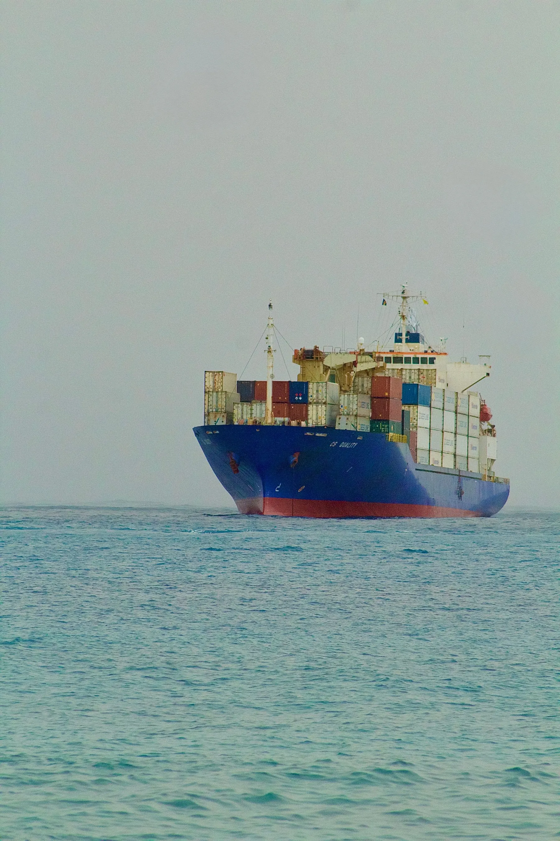
Ten days out
Anyone can track a ship. We call the arrival ten days before it happens.
Polaris is our arrival‑forecast engine. Ten days out it typically lands within about a day and a half of the real arrival, and even four weeks out a bulk carrier’s forecast typically lands within about 2.7 days, less than a tenth of the time still to run. The AIS field gives you one number and no idea how wrong it is. Ours comes graded against 349,000+ realized arrivals, and that record is the proof behind every piece of DMI work.
A conceptual plot. Time runs left to right, from ten days before arrival to the arrival itself; height is the vessel’s remaining distance to the berth. The Polaris forecast is a shaded gold window that starts wide ten days out and narrows onto the realized arrival. The AIS estimate is a single dashed rule standing apart from that window, with no band around it. A solid rule marks the realized arrival — the hour the ship was actually tied up.
AIS ETA · one guess
one number, no stated range
Realized arrival
the hour the ship tied up
Polaris · calibrated window
narrows as the ship closes
Days before arrival 10 → 0
Distance to berth
Drawn to show the shape of the comparison — the measured figures live in the ledger.
Shorter is better.
-
Polaris
1.5d
A graded window with a stated range — and it narrows as the ship closes.
-
AIS ETA (CREW-ENTERED)
Not published
One number, with no error figure to size it against.
Both bars run on the same scale — zero to ten days of arrival error. The hatched bar runs off the end because no figure is published to draw it to.
-
Typical error at ten days out, as each method publishes it
- AIS ETA (CREW-ENTERED)
- No error figure published
- Polaris
- 1.5d typical, with a stated range
Only one of the two publishes an error figure at all — which is the comparison.
Accuracy record
Every forecast is scored against what actually happened.
Every forecast is checked against the real arrival — the hour the ship is actually tied up at the berth — and only on voyages the forecast never saw while it was being built.
Each ETA ships as a window, and we publish how often that window is right, so you know how far to trust it before you lean on it.
The figures below are measured across the whole production footprint: eight Gulf Coast ports worked daily, 97 ports in production across the wider trade.
Most accuracy claims in this market arrive with no graded record behind them. This one does.
- Typical
- The middle of the graded errors: half the forecasts miss by less than the figure shown, half by more.
- Graded
- Scored after the fact against the hour the ship was actually tied up at the berth, on voyages the forecast never saw.
How we grade
Typical arrival error
- 1.5 d Ten days out
- 1.9 d Two weeks out
- 3.1 d Four weeks out
- 2.7 d Of which, bulk carriers only
Every figure above is measured against what actually happened, voyage by voyage, and logged.
Record last graded July 2026
Downloads
Direct download, no form.
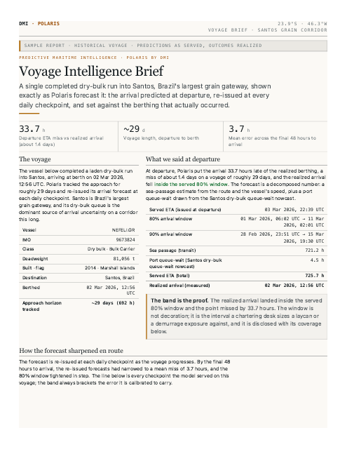
- Sample voyage brief A complete delivered report, exactly as a client receives it — a real voyage against its graded record.
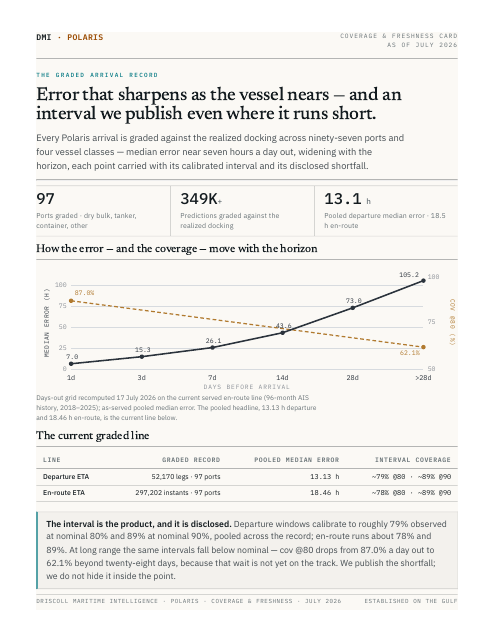
- Coverage & freshness summary The ports and vessel classes we cover, and how recently the record was graded.
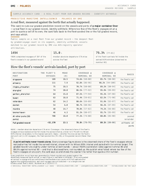
- Sample fleet accuracy card The per-fleet accuracy card format, shown on a worked example.
An accuracy card is a one-page graded error record for the ports or vessels you name. Send yours and we send it back free.
About
A maritime intelligence firm working the Gulf Coast first.
We work one stretch of coast closely enough to be specific about it, and we stay answerable for every number we publish.
DMI is run by Luke Driscoll. When you commission work, he is who you deal with, start to finish. The method is on the table, the Polaris record is graded in the open, and the same record is downloadable above.
- Method
- AIS tracks run through our own forecasting models, built and tuned in-house. Nothing is resold: the forecasts are ours, and so is the error record beside them.
- Coverage
- Eight U.S. Gulf Coast ports worked daily — Houston, New Orleans, Corpus Christi and the export gateways along the coast — inside 97 ports running in production across the wider trade.
- Who you deal with
- Founder-led and independent. You reach the principal who does the work, usually with a same-day reply.
Start a conversation